
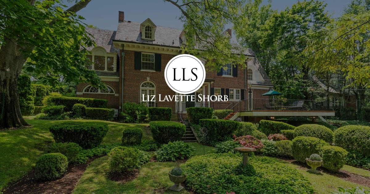
Bethesda, Maryland is a Red Line-anchored suburb of Washington, DC that holds three distinct sub-areas inside a roughly four-square-mile footprint. Downtown Bethesda is a high-rise, condo-heavy walking district built around the Bethesda Metro station on Wisconsin Avenue. West of it, Edgemoor and Kenwood sit on quarter-acre to half-acre lots under a tree canopy that reaches full cover by mid-April. South and east of downtown, 1950s and 1960s single-family blocks run toward Chevy Chase, Maryland and the Capital Beltway. The Bethesda CDP population was 68,056 as of the U.S. Census Bureau's 2022 American Community Survey (Census QuickFacts for Bethesda CDP, retrieved November 2026). What ties the three sub-areas together is Montgomery County Public Schools, the WMATA Red Line, and proximity to the National Institutes of Health campus on Rockville Pike. What separates them is price per square foot, walkability, and whether you drive or Metro to dinner.
What are the three distinct sub-areas of Bethesda?
Bethesda functions as three different neighborhoods stitched together along Wisconsin Avenue (MD-355), and the differences are large enough to change what you buy and how you live. Downtown Bethesda is dense and vertical, the estate neighborhoods west of it are horizontal and private, and the inner-suburb grid east and south runs older single-family stock on smaller lots. The table below shows the practical distinctions buyers weigh during a first tour.
| Sub-area | Primary housing type | Typical lot size | Walk to Bethesda Metro | Character |
|---|---|---|---|---|
| Downtown Bethesda | Mid- and high-rise condominiums | None (vertical) | Zero to 10 minutes | Urban grid, Bethesda Row, restaurants, Capital Crescent Trail |
| West Bethesda (Edgemoor, Kenwood, Bradley Hills) | Detached single-family | 7,500 sq ft to 1 acre | 10 to 25 minutes | Mature canopy, Kenwood cherry blossoms, estate-scale homes |
| Inner-suburb Bethesda (Glenbrook, Battery Park, Wyngate) | Detached single-family and townhomes | 5,000 to 9,000 sq ft | 20 to 40 minutes (often requires car) | 1950s-1960s brick colonials and Cape Cods, teardown-and-rebuild activity |
Sources: Montgomery County Planning sector plans and Maryland SDAT real-property records, retrieved November 2026 (Montgomery Planning Pike District Small Area Plan, Maryland SDAT Real Property Search). Walk times are from the Bethesda Metro station entrance at 7700 Wisconsin Avenue, measured in WMATA's station proximity tool.
The buyer mistake to avoid is treating all three as interchangeable. A downtown condo and a Kenwood single-family are not two price points on the same ladder. They are different products for different lives. A condo gives you a lock-and-leave routine and a walkable block radius; an Edgemoor or Kenwood house gives you a yard, a garage, and the maintenance that comes with both.
Where does Bethesda sit on the Washington DC transit map?
Bethesda sits immediately northwest of the DC-Maryland line along the Red Line Metro, with three stations serving the area directly. The Bethesda station at 7700 Wisconsin Avenue anchors downtown. The Medical Center station at 8700 Rockville Pike serves the National Institutes of Health and Walter Reed campuses. The Friendship Heights station straddles the DC line and handles the southern end of the Bethesda search. From the Bethesda station platform, trips to Metro Center run roughly 15 minutes and trips to Union Station run roughly 25 minutes during standard service, per the WMATA Trip Planner (retrieved November 2026).
Two transit changes matter for anyone buying in 2026 or 2027. The Purple Line, a 16.2-mile light-rail project under construction by the Maryland Transit Administration, will connect Bethesda to Silver Spring via Chevy Chase and Takoma, with a Bethesda terminus beside the existing Red Line station. The current revenue-service target is late 2027, per the Maryland Transit Administration Purple Line project page (retrieved November 2026). A scheduled Red Line service change also affects the Medical Center and Bethesda stations during a weekend-track-work window announced by WMATA for summer 2026; verify current status at the WMATA service advisories page before you tour.
Drivers use I-495 (the Capital Beltway), MD-355 (Wisconsin Avenue through downtown, Rockville Pike north of it), and the Clara Barton Parkway. Rush-hour Beltway travel times from Bethesda to Tysons Corner or Alexandria vary widely; the realistic planning assumption is 25 to 45 minutes on either leg.
Who lives in Bethesda, and where do they work?
Bethesda's resident base skews toward federal, medical, and research employment, which is why the housing market tracks the hiring cycles of large anchor institutions rather than any single private industry. The median household income for the Bethesda CDP was $204,323 as of the Census Bureau's 2022 American Community Survey 5-year estimates (Census QuickFacts for Bethesda CDP, retrieved November 2026). That number tells you the area absorbs costs, not that it is uniformly expensive block by block; price per square foot varies substantially between downtown condos and West Bethesda single-family.
The large employers inside the Bethesda footprint include the National Institutes of Health main campus at 9000 Rockville Pike (over 300 acres and 20,000-plus employees, per the NIH Office of Research Services), the Walter Reed National Military Medical Center across Rockville Pike from NIH (consolidated at this site after the 2011 Base Realignment and Closure action, per the Defense Health Agency), Suburban Hospital on Old Georgetown Road (a Johns Hopkins member hospital), and the Lockheed Martin corporate headquarters at 6801 Rockledge Drive. Commuters into downtown DC remain a sizable share of the daily flow, which is why Red Line walking distance is a persistent factor in Bethesda pricing.
How does the housing stock break down by neighborhood?
Bethesda's housing stock is three categorically different products sitting within five miles of each other, and getting the category right before you look at listings prevents wasted tours. Downtown Bethesda is dominated by condominium buildings with elevators, concierge or front-desk coverage, and monthly fees that typically cover common-area maintenance, water, trash, and sometimes basic cable. Building vintage matters: pre-2005 buildings generally have lower reserve requirements but may face deferred-maintenance special assessments; post-2010 buildings carry higher fees but newer mechanical systems. Pull two years of association meeting minutes and the reserve study before you offer on any downtown condo.
West Bethesda is the estate-scale detached-home belt. Edgemoor sits immediately west of downtown and is walkable to the Red Line from its eastern blocks. Kenwood, famous for the yoshino cherry trees that bloom along Kenwood Country Club roads in late March and early April, is a Kenwood Citizens Association neighborhood with established architectural and tree-canopy expectations. Bradley Hills and Burning Tree continue west and north of Kenwood, with larger lots and longer drives to the Metro. Expect Georgian, Colonial, Tudor Revival, and mid-century custom homes, with ongoing teardown-and-rebuild activity in the two-acre and larger lot strata.
Inner-suburb Bethesda runs south and east of downtown toward the DC line and the Chevy Chase MD boundary, and the Capital Beltway. Housing here is predominantly 1950s and 1960s brick-fronted colonials, split-levels, and Cape Cods, with lot sizes in the 5,000 to 9,000 square foot range. Permit activity through the Montgomery County Department of Permitting Services shows active teardown-and-rebuild volume in Glenbrook, Battery Park, and Wyngate, with new builds routinely exceeding 4,500 square feet on former 2,200-square-foot rambler footprints.
What does the Red Line actually give you day-to-day?
The Red Line is Bethesda's defining practical feature, and the difference between a five-minute walk to the Bethesda station and a 25-minute walk is the difference between a true transit lifestyle and an occasional-rider lifestyle. Buyers who weight Metro proximity heavily cluster in the condo buildings along Woodmont Avenue, East-West Highway, and Old Georgetown Road, where the station entrance is reliably within a 10-minute walk. From the Bethesda station, inbound trips to Dupont Circle run approximately 10 minutes, to Metro Center 15 minutes, to Union Station 25 minutes, and to Reagan National Airport 35 minutes via a single Yellow Line transfer at Gallery Place, per the WMATA Trip Planner (retrieved November 2026).
Two caveats matter for commute planning. First, the Red Line runs single-tracking service during many weekend maintenance windows, which adds 10 to 20 minutes to weekend trips; track the WMATA service advisories page before committing to a condo that relies on weekend transit. Second, the Purple Line light-rail project will add an east-west connection at the Bethesda station to Silver Spring, with a current target of late 2027 for revenue service (Maryland Transit Administration Purple Line project page, retrieved November 2026). Buyers looking at post-2027 commute patterns should map the Purple Line stops in their calculation, particularly if they are weighing Bethesda against Silver Spring or Takoma Park.
What are Bethesda's public spaces and civic anchors?
The Capital Crescent Trail is the defining linear public space, running 11 miles from the Bethesda Metro area southeast to Georgetown along the former Georgetown Branch rail corridor, with paved surface and limited at-grade crossings (Montgomery Parks Capital Crescent Trail page, retrieved November 2026). The trail is a daily walking and cycling route for downtown Bethesda residents and connects to the C&O Canal Towpath at its DC end. Bethesda Row, operated as a mixed-use retail and restaurant district by the Bethesda Urban Partnership and private developers, sits between Elm Street and Bethesda Avenue immediately south of the Metro station and anchors the downtown pedestrian grid (Bethesda Urban Partnership, retrieved November 2026).
Civic anchors include the Bethesda branch of the Montgomery County Public Libraries on Arlington Road, the Strathmore performing-arts center in adjacent North Bethesda (two Red Line stops north), the Bethesda-Chevy Chase Rescue Squad on Battery Lane, and the Bethesda Fountain at the historic Wisconsin-East-West-Old Georgetown intersection. The ongoing North Bethesda Pike District Small Area Plan, administered by Montgomery County Planning, continues to add density, mixed-use buildings, and transit-oriented infrastructure along the Rockville Pike corridor between the Grosvenor-Strathmore and White Flint Metro areas (Pike District Small Area Plan, retrieved November 2026).
What does the Montgomery County property tax picture look like for Bethesda?
Bethesda is inside Montgomery County, Maryland, which means the county property tax structure, not the DC rate schedule or Maryland's statewide rate, is what owners pay. The Montgomery County general-fund real property tax rate was $0.9796 per $100 of assessed value for fiscal year 2026, per the Montgomery County Department of Finance (retrieved November 2026). Bethesda properties also fall within special taxing areas that add surcharges for transit, parking, and urban-services districts; downtown Bethesda condos in particular may carry Bethesda Urban District surcharges. Pull the specific tax bill history for any address through the Maryland SDAT Real Property Search before you underwrite a monthly budget.
Montgomery County Public Schools (MCPS) assigns Bethesda addresses to one of three high-school clusters depending on street: the Walt Whitman cluster in West Bethesda, the Bethesda-Chevy Chase cluster in central and southern Bethesda, and the Walter Johnson cluster in the north and east. Boundaries shift periodically; verify any specific address through the MCPS School Assignment Tool before you remove a school contingency.
How should a buyer tour Bethesda for the first time?
A productive first tour of Bethesda covers all three sub-areas in a single day, in deliberate sequence, so the comparison lives in your short-term memory rather than across three separate weekends. Start at the Bethesda Metro station on a weekday morning around 8:30 a.m. to see the downtown commute flow and the Bethesda Row pedestrian pattern at a working hour. Walk Wisconsin Avenue and Woodmont Avenue, note the condo buildings with doorman service versus self-serve entries, and step inside one or two lobbies to feel the finish level.
Mid-morning, drive or rideshare west into Edgemoor and Kenwood. Park on Dorset Avenue or Edgemoor Lane and walk a block in each neighborhood. Lot scale and canopy are the two variables you cannot read from listings. Then continue south into Bradley Boulevard and east back toward Old Georgetown Road, routing past Burning Tree to see the price-tier ceiling. Early afternoon, drive the inner-suburb grid: Glenbrook Road, Battery Lane, and Wyngate Drive are representative blocks for the 1950s-1960s stock and the active teardown-and-rebuild pattern.
Close the day back at the Bethesda station at 5:30 p.m. and ride one stop inbound to Friendship Heights. The round-trip tells you what a daily commute actually feels like, including the station-entrance walk and the escalator wait. For the deeper read on the full Bethesda market, pricing, transfer taxes, and the cross-jurisdictional comparison with Chevy Chase MD and Northwest DC, work from the Bethesda MD real estate guide. Buyers weighing a Bethesda purchase against a Washington DC luxury home should also read the Washington DC luxury homes complete buyer guide. Anyone relocating from outside the DMV should start with the relocating to Washington DC primer before scheduling the tour.
Frequently Asked Questions
What is Bethesda MD actually like as a place to live?
Bethesda is a Red Line suburb of Washington, DC made up of three distinct sub-areas: a dense walkable downtown around the Bethesda Metro station, a West Bethesda estate belt in Edgemoor, Kenwood, and Bradley Hills, and an inner-suburb grid of 1950s-1960s single-family homes east and south of downtown. Bethesda sits inside Montgomery County, so county property tax rates and MCPS school assignments apply, not DC rules. The daily routine is shaped by the Red Line commute, the Capital Crescent Trail, and proximity to NIH and Walter Reed.
Where is Bethesda, Maryland in relation to Washington, DC?
Bethesda is immediately northwest of the District of Columbia, directly over the DC-Maryland line along Wisconsin Avenue (MD-355). The Bethesda Metro station is three Red Line stops from Metro Center and roughly 15 minutes of inbound travel time during standard service, per the WMATA Trip Planner. Friendship Heights at the south end of Bethesda straddles the DC line.
What are the main neighborhoods inside Bethesda?
The widely recognized Bethesda neighborhoods are downtown Bethesda (condo buildings around the Metro), Edgemoor and Kenwood (West Bethesda estate neighborhoods, Kenwood known for its cherry-blossom streets), Bradley Hills and Burning Tree (larger-lot residential north and west), and the inner-suburb grid of Glenbrook, Battery Park, Wyngate, and similar 1950s-1960s subdivisions to the south and east. Friendship Heights at the DC line is often treated as its own sub-market.
Is Bethesda inside Washington, DC or Montgomery County, Maryland?
Bethesda is in Montgomery County, Maryland, not Washington, DC. Property taxes, school assignments, transfer taxes, voter registration, and local permits all follow Montgomery County rules. The confusion comes from Bethesda's DC-adjacent location and its DC-area 20814, 20815, and 20816 ZIP codes.
How does the Bethesda Metro station work?
The Bethesda station is on the Red Line at 7700 Wisconsin Avenue, with a single primary entrance beside Bethesda Row. Inbound trips head toward Glenmont via downtown DC; outbound trips head toward Shady Grove. The Purple Line light-rail project under construction by the Maryland Transit Administration will add east-west connections at the Bethesda station to Silver Spring and Chevy Chase, with a current revenue-service target of late 2027.
What is the median household income in Bethesda MD?
The Bethesda CDP median household income was $204,323 as of the Census Bureau's 2022 American Community Survey 5-year estimates, per Census QuickFacts retrieved November 2026. This is a CDP-wide average and masks substantial block-level variation between downtown condos, inner-suburb single-family, and the Edgemoor and Kenwood estate blocks.
What public schools serve Bethesda?
Bethesda addresses fall into Montgomery County Public Schools (MCPS), assigned by street to one of three high-school clusters: Walt Whitman in West Bethesda, Bethesda-Chevy Chase in central and southern Bethesda, and Walter Johnson in the north and east. Elementary and middle-school assignments vary within each cluster. Verify the exact assignment for any address through the MCPS School Assignment Tool before removing a school contingency.
Who should I work with on a Bethesda home purchase?
Work with a buyer's agent licensed in Maryland who regularly closes in Montgomery County, not only in Washington, DC. Bethesda transactions use Maryland contracts, Maryland transfer and recordation taxes, Maryland disclosure forms, and MCPS school-boundary verification. Liz Lavette Shorb of Washington Fine Properties has over three decades of experience across the Washington metropolitan area including DC, Maryland, and Northern Virginia. Reach the Liz Lavette Shorb team through the agent page or the contact page.
Reviewed by Liz Lavette Shorb, Washington Fine Properties. Last reviewed: November 2026.